Introduction:
Flooding is an issue that affects many cities and towns located on rivers and other water bodies. In order to prevent damaging effects from floods including property damage, economic loss on farm fields, and loss of human life, there needs to not only be an understanding of the mechanisms of floods, but also of flood history (Karatzas, 2017). The Chippewa River Valley in particular has been subject to floods since settlers first came to the area (Wisconsin Historical Society, 2017). As technology has advanced so have flood prevention measures and the ability to determine flood hazard zones. However, these flood prevention measures are only as effective as the data they reference. This data is hindered by an insufficient instrumental record of river levels (Therrel and Bialecki, 2015). One way to recreate flood history before instrumental records is by using tree rings. When a tree experiences a flood under the right conditions, it will create a flood ring, which can then be observed in a tree core sample (Therrell and Bialecki, 2015). This method is a new development in dendrochronology and flood rings have very specific conditions under which they form including the timing of the flood and growth in trees, the temperature, the total time the tree was inundated, and the species of tree. To support this relatively new and uncertain flood ring analysis technique, a flood hazard map of Wisconsin, including the area surrounding Brush Island in the lower Chippewa River valley, will be created showing which areas are most likely to flood and thus indicate which trees might have flood rings.Methods:
In this analysis, five
different data layers were used: rainfall layer, DEM of Wisconsin, soil
characteristics layer, land cover layer, and a rivers and streams layer. Each layer was projected in the
NAD_1983_HARN_WI_TM projection which is specific to Wisconsin. The DEM of Wisconsin was used to create a
slope layer, flow accumulation layer, and an elevation layer. To obtain the rainfall layer, monthly averages
of rainfall for cities in Wisconsin obtained from the NOAA National Climatic
Data Center (2017) were transferred to Excel. Then using the
Modified Fournier Index (MFI), an equation that
sums the square of the monthly average rainfall divided by the yearly rainfall
for all twelve months, an MFI indicator was created that indicates the sum
of the average monthly rainfall intensity for an area (Figure 1). MFI is used because it has been determined to be
acceptable for mapping rainfall intensity (Kourgialas and Karatzas, 2017). These
were incorporated into a new field of a geocoded Wisconsin cities feature class
and the spline method of interpolation created a raster of average monthly
rainfall intensity because it is best
for creating a smooth surface of varying data (Kourgialas and
Karatzas, 2017).
 |
| Figure 1. MFI equation. |
Using spatial analyst, the slope raster function was performed on the DEM layer to determine slope in the study area. Flow accumulation was obtained by first creating a flow direction raster (using the flow direction tool in spatial analyst) from the DEM and subsequently using the flow accumulation tool. The soil characteristics layer had to be converted using the polygon to raster tool in order to create a raster usable in the analysis. For the rivers and streams raster, a Euclidean distance tool created a gradient of distance from the river and stream network. The rainfall, slope, flow accumulation, and rivers and streams layer all had to be converted from a floating point to an integer raster because weighted overlay analysis only works on integer rasters. Then, the rainfall, slope, flow accumulation, and elevation rasters had to be projected into the correct coordinate system to perform the analysis.
Finally, all the rasters had to be separated into four classes using the reclassify tool. The elevation, flow accumulation, slope, rivers and streams, and rainfall layer were all separated into four classes using the natural breaks method, which was used based in previous studies (Kazakis et al., 2015). Land cover and geology (soil types) are composed of descriptive classes, and so their classes were determined based on the research results of both Kazakis et al. (2015) and Kourgialas and Karatzas (2017). Each of these layers was then inputted to an extension called analytic hierarchy process. This extension creates a weighted value for each raster based on a table showing the importance of a variable relative to others. The values for this table came from Kazakis et al. 2015 (Figure 2).
 |
| Figure 2. AHP values for weighted overlay analysis. |
Then all seven rasters were imported to weighted overlay analysis, each raster was assigned its weight (as a percentage), and each class previously created with the reclassify tool was assigned a ranking of either 1, 3, 5, or 7. The rankings were determined using both Kazakis et al. (2015) and Kourgialas and Karatzas (2017) as a guide. Finally, the tool was run and a map was produced showing flood hazard areas for all of Wisconsin. The work flow for this map is pictured below.
 |
| Figure 3. Workflow for creating the flood hazard map. |
Results:
 |
| Figure 4. Flood hazard map of Wisconsin. |
 |
| Figure 5. Flood hazard map of the area surrounding Brush Island. |
The final product shown in figure 4 was a
flood hazard analysis map of the state of Wisconsin with four categories: very
high, high, medium, and low. The categories were
determined using ranks and weights assigned to each variable via analytic
hierarchy process and previous research.
Figure 5 shows that the area surrounding Brush Island, the area where
tree cores were obtained for recreating a flood history of the Chippewa River,
is completely encased in the very high flood zone. This indicates the Brush Island has a high
likelihood of flooding and thus the trees are likely to contain flood
rings. In general, areas surrounding
rivers like the Chippewa River are more likely to flood than areas farther
away. The lower half of Wisconsin is
also generally more susceptible to flooding based on figure 2. Important to note is the raster analysis
was limited by the 30 meter DEM and thus the precision of the findings is
limited.
Conclusion:
Figure 3 shows that the
Brush Island area is likely to flood based on the raster analysis
performed. This indicates that tree
cores from the island are likely to have flood rings and validates previous
predictions that obtaining tree cores from this area will yield flood rings.
Tree ring data from Brush Island can then be used to recreate a flood history
of the Chippewa River before instrumentation records were present. This data combined with instrumentation
records will give government officials and other groups a more complete and
comprehensive flood history that can be used for planning, insurance policies, and
future flood prevention measures. While
the raster data used for this analysis is recent (DEM, soil characteristics, flow
accumulation) and the flood rings are dated farther back, the Chippewa River
has not drastically changed in the last 200 years and thus general comparisons
and analysis can be done using previous flood data (tree rings) and recent
raster data. The final raster was limited by
its 30 meter DEM and limited rainfall data so fine scale analysis is not possible, but
general trends can be determined. This
map is recommended for general use and coarser scale trends in
flood hazard analysis of Wisconsin.
Sources:
NOAA National Climatic
Data Center. (2017). NOAA’s 1981-2010
Climate Normals [data file]. Retrieved
from https://www.ncdc.noaa.gov/cdo-web/datasets/NORMAL_MLY/locations/FIPS:55/detail
Current Results Publishing Ltd. (2017). Average Precipitation for Wisconsin. Retrieved from https://www.currentresults.com/Weather/Wisconsin/precipitation-january.php
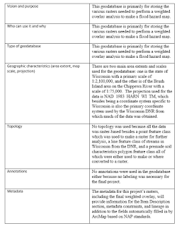
Wisconsin Department of Natural Resources. (2017). DNR Geodatabase. (Geodatabase). Wisconsin: Wisconsin Department of Natural Resources. Web. 23 Sep 2017. http://dnr.wi.gov/maps/GetGISData.html
Therrell, M. D., & Bialecki M. B. (2015). A multi-century tree-ring record of spring flooding on the Mississippi River, Journal of Hydrology, 529(2), 490–498. doi:10.1016/j.jhydrol.2014.11.005.
Xiao, Yangfan, Shanzhen, Yi, Zhongquian, Tang. (2017). Integrated flood hazard assessment based on spatial ordered weighted averaging method considering spatial heterogeneity of risk preference, Science of the Total Environment, 599-600, 1034-1046. http://dx.doi.org/10.1016/j.scitotenv.2017.04.218
Kourgialas, N.N., & Karatzas, G.P. (2017). A national scale flood hazard mapping methodology:The case of Greece- protection and adaptation policy approaches, Science of the Total Environment, 601-602, 441-452. http://dx.doi.org/10.1016/j.scitotenv.2017.05.197
Kazakis, N., Kougias, I., and Patsialis, T. (2015). Assessment of flood hazard areas at a regional scale using an index-based approach and Analytical Hierarchy Process: application in Rhodope-Evros region, Greece, Science of the Total Environment, 538, 555-563.http://dx.doi.org/10.1016/j.scitotenv.2015.08.055
Wisconsin Historical Society. (2017). Floods in Wisconsin. Retrieved from https://www.wisconsinhistory.org/Records/Article/CS2507


No comments:
Post a Comment